What does "Bortle Scale" on the map mean? How should I interpret it?
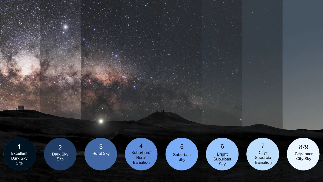
Calculate equivalent exposure times for astrophotography based on light pollution conditions.
Searching...
Natural night sky
Rural sky
Suburban sky
Urban sky
City core
Minimal aurora activity expected
Possible aurora visibility under dark skies
Strong aurora activity expected
Excellent aurora viewing conditions


Our system analyzes your approximate location based on your IP address and automatically displays the Bortle class for that area. You can also search for specific addresses or manually explore the map to discover optimal stargazing spots in other regions.

We're in the process of integrating real-time aurora prediction tools (such as KP index) and observation layers into our map. This will help users in high-latitude regions like Northern Europe, Canada, and Alaska track and pursue aurora sightings.
Absolutely! The map combines light pollution levels with geographical data to help you locate ideal spots for Milky Way observation and photography. We're also planning to add features like Milky Way rise times and direction to support astrophotographers in efficiently planning their shoots.

https://lightpollutionmap.app/?lat=25.3125&lng=-80.6875&zoom=8. Use this to share locations or bookmark your favorite stargazing places. Just change the latitude (lat), longitude (lng), and zoom level.We're planning to build a community for stargazing enthusiasts where users can upload field observation reports, photos, and suggestions. This will enrich our map data and allow users to share their observation experiences.
Our website's basic features are permanently free to use. Currently, we don't have plans for a membership program, so you can use our light pollution map with confidence.
The map helps stargazers quickly find suitable observation locations nearby and provides Bortle class information along with basic astronomical guidance. We plan to expand beginner tutorials and observation recommendations in the future to help you easily start your stargazing journey.
Help raise awareness about light pollution! Share this map with friends and family to show how light pollution affects our night sky.
Embed this interactive light pollution map on your website. The embed code preserves the current location, zoom level, and active layers.